Artificial Reef Pre-Deployment Survey
Harms Ledge Permitted Area 10-4-19
Final Report
Prepared for:
The City of Jacksonville
Water Quality Branch
Environmental Quality Division
Environmental & Compliance Dept.
407 N. Laural Street, Suite 300
Jacksonville, FL 32202
Re: Jimmy Dales Tugboat Reef Pre-Deployment Survey Permit No: SAJ-2007-00264-SCW
Prepared by:
Kistel Media LLC
Summary:
To verify an adequate reef deployment location for the upcoming Jimmy Dales Tugboat reef creation project, a dive team identified and surveyed an area of seafloor within the boundaries of the Harms Ledge area (Permit No: SAJ-2007-00264-SCW) on 10-4-2019. The Harms Ledge area may also be referred to as “HL” in the remainder of this document. Results of the survey efforts suggest the area is adequate to place the anticipated metal vessel reef materials. Divers that participated in dive survey and data collection efforts included Joe Kistel and Ed Kalakauskis. Operations support included Chuck Darner and his vessel crew.
Site Selection:
A location within the HL permitted area was to be identified and surveyed to determine its adequacy to accept metal vessel artificial reef material. The site selected and surveyed is referenced in the graphic below.
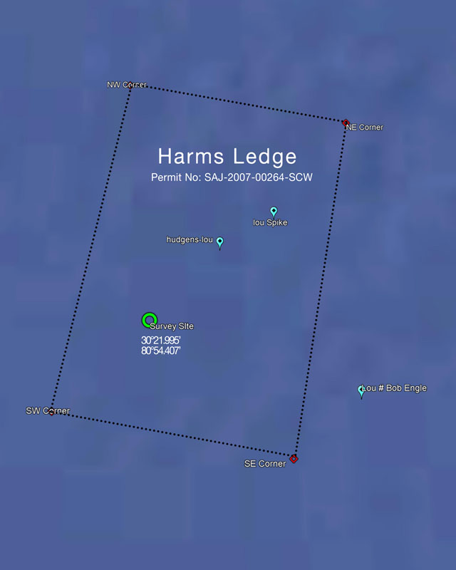
Harms Ledge Permit area
The area surveyed (noted by the green circle in the above graphic) is strategically located in the southwest quadrant of HL, approximately .4 miles from the nearest permitted zone boundary line.
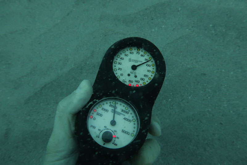
Prior to initiating the dive survey, east-west transects were conducted in a northerly direction using the diving vessel to investigate the area at large with an onboard Garmin depth finder. The sonar equipment displayed a depth on average of 95 feet and a seafloor flat and free of obvious live bottom. Appearing to be an adequate location from the sonar instrumentation observations, the anchor of the vessel was dropped at 30° 21.995’ 80° 54.407’. The anchor location served as the center point of our survey efforts.
The image below identifies the selected site in reference to the Mayport Jetties. The site is just over 28 miles, at a 94.25° heading, from the mouth of the Jacksonville Jetties.
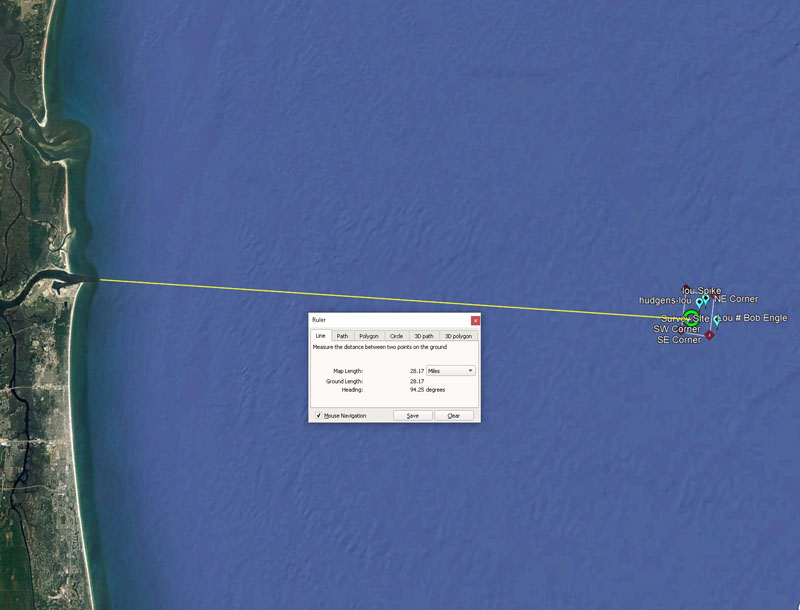
Distance from Mayport Jetties
Pre-Deployment Scuba Dive Survey:
Once the site referenced above was identified, divers entered the water for further site analysis. Divers performed a 300-foot diameter circular sweep, observed marine life, photographed the area, and probed the sea floor.
During the dive efforts the temperature on the sea floor was about 80°F. Visibility at the sea floor was estimated to be 10 feet and a minimal current was noticed.
Radial Sweep Circular Survey:
Then dive team attached the free end of a measuring reel to the anchor on the seafloor. The anchor served as the benchmark and center point of the area surveyed. The dive team then traveled at a heading of 0° from the anchor until they reached the 150 foot mark. They made a mark in the sand here to use as a visual reference to know when they have completed a full circle sweep. From that point the team turned towards the east, and with their reel line taught, began to swim easterly. The dive team swam a giant circle swimming until they returned back to their north starting point (where they made their mark in the sand). The diameter of the sweep completed was 300 feet. The divers reel was never snagged throughout the entire swim. This indicated that no obvious signs of live bottom as the reel line would have likely snagged any protrusions sticking out of the sea floor.
Observations:
- No obvious live bottom such as natural reefs, sponge beds, and/or gorgonian forest were encountered within the 300-foot diameter area swept.
- The bottom appeared primarily flat with a stiff sandy bottom substrate. Very little ripples in the sand substrate were observed in some areas.
- The bottom substrate was primarily sand with some smaller aggregate including shell pieces.
- Invertebrate life observed included sea stars, sea urchins, and mollusk.
- The few fish observed included cigar minnows and a possible small flounder.
Marine life:
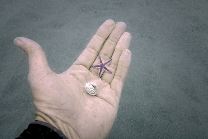
Diver Kistel shows a Sea Star and Mullusk found during the survey.
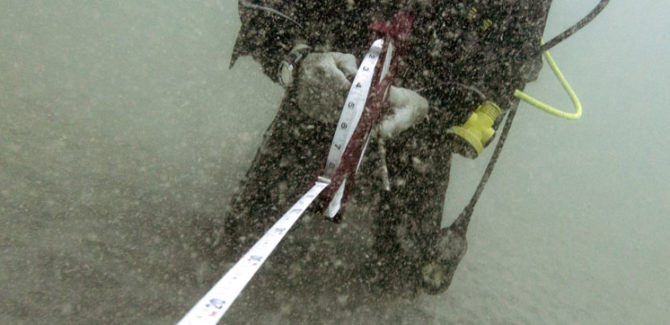
Sediment Probing:
A steel ½ inch diameter metal probe was used to randomly pierce the sea floor throughout the area surveyed. The sea floor firmness, noted by the depth the probe penetrated the substrate, perhaps provides some indication of future reef materials ability of not sinking into the sea bed. The diagram below shows the depths of probe penetration at various locations of the surveyed area. On average, the probe penetrated roughly 6 inches deep indicating a stable substrate.
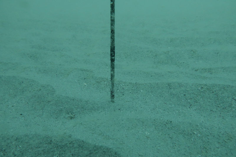
Sediment Probe
Conclusions:
Based on the results of the survey efforts, the area located at 30° 21.995’ 80° 54.407’ appears adequate for the future deployment of metal vessel reef materials.
-The recommended site is within HL permitted area (Permit No: SAJ-2007-00264-SCW)
-No obvious signs of “live bottom” were discovered within the area surveyed and 200 feet outside the surveyed area boundaries.
-Sediment penetration suggests a relatively firm substrate base.
-The average depth of the site was documented at 95 feet based on scuba divers’ instrumentation. This depth allows for over 45 feet of relief of reef materials to stay within the permit requirements of 50 foot sea surface clearance.
Sediment photograph at 30° 21.995’ 80° 54.407’:
Special Thanks:
- Divers Joe Kistel, Ed Kalakauskis
- TISIRI
- Chuck Darner and Crew
- Kistel Media
- Mobro Marine (providing Vessel and deployment resources)
- The City of Jacksonville
